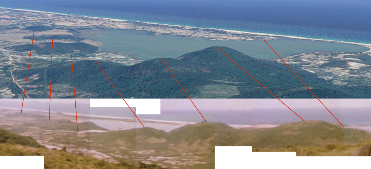
Correlation, 23 June 1967
Putting together stills from Larry Douglas' film, we can find a correlation with the topography on the Vietnam coast as shown in contemporary Google Earth satelite images, as seen in this correlation.
Using the DSJs and related maps, we can see that "A" Company had flown in from LZ Uplift to somewhere near the point that represents the line of sight. This can be shown on an extended Army map.
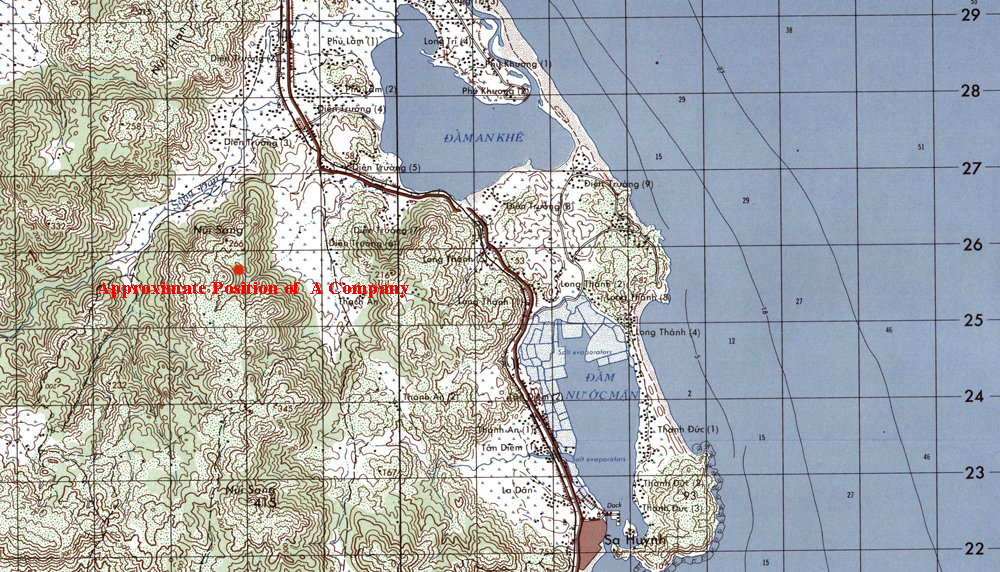
The DSJ for 23 June 1967 and associated Map, shows that the company was at BS 893250 at 0915 hours. The line of sight position is 879257, a difference of a little more than a kilometer. If the landing was effected at 0800 hours, this would give an hour and fifteen minutes to reach the point recorded in the DSJ. The landing time was unrecorded, and given the time of year, it could have been 0700 hours, as there is plenty of daylight prior to this time around the summer solstice.